top of page
Based at INSTAAR,
University of Colorado, Boulder

Gallery of Outputs
Bass Strait marine benthic habitats in the planning for offshore wind energy
Detailed mappings of the region's benthic substrates were supplied to CSIRO Data61.
Planning announcements for the projects have been released: https://www.dcceew.gov.au/energy/renewable/offshore-wind/areas/bass-strait
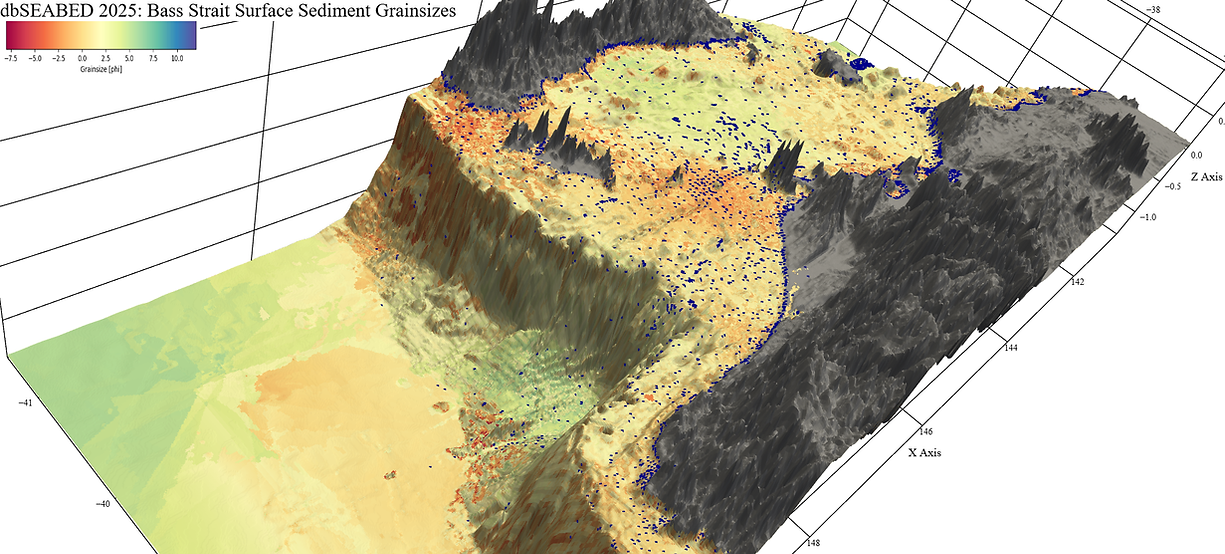
This image shows the results of this synthesis for the eastern areas including Tasmania (top) Bass Canyon, Flinders Island and the Gippsland. It shows (colours) the seafloor sediment grainsizes from -8phi (cobbles) to +10phi (clays). Blue dots show the supporting data points. The adjacent abyssal plain areas are very poorly represented in the presently available data.
2025
Marginal Enclosed Seas
Baltic Earth, Working Group “Marginal Seas – Humans and Environment”
https://baltic.earth/working_groups/marginal_seas
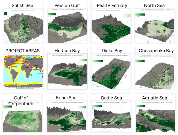
In this project very detailed mappings of the bottom substrates were needed for 12 small seas / bays around the world, to support studies of benthic ecology diversity in human-affected areas. The human effects may be urban or fishery.
Here the 3D terrain plottings of percent mud contents are shown, dark green to white 100% to 0%. Land areas grey.
April 2026
bottom of page